HEY AIRSLOT.......

well the boss has a vacation house in reedville, va on the chesapeake bay. we are going fishing there in october, and i am taking my boat. it is a 5 hour drive from here and I dont want to haul the old girl that far.

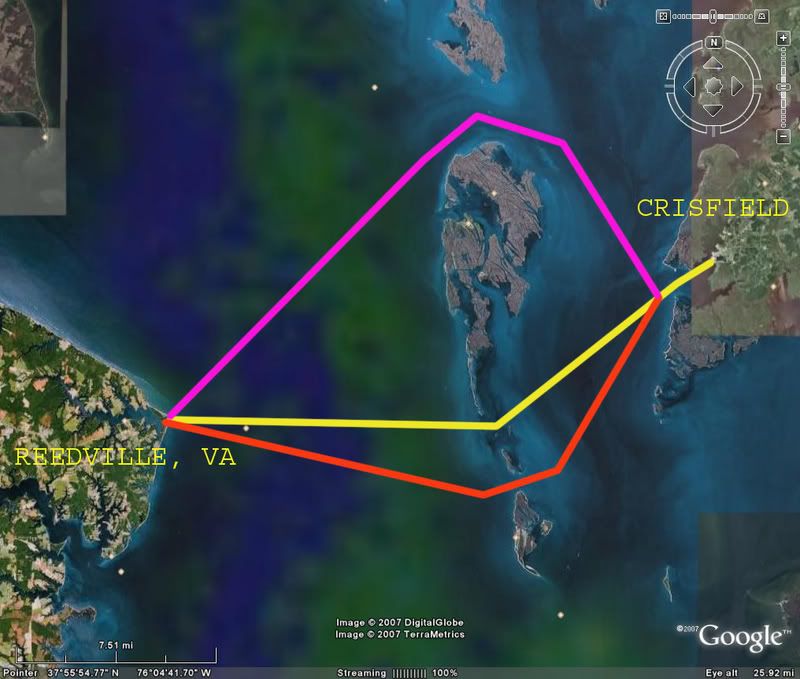
So my question is......

can I do any of these courses??? I figured you would be the one to know ;)

How long do you think it would take at 30 mph on a calm day???

CHES-A.jpg
 
My baycharts are in the boat. The northern route you drew is the longest and safest. The two southern routes may be real iffy, lots of stumps if I can recall.

I'd probably go through smith island, the Thorofair as it is called.


After looking, I'll have to check my charts. I think the yellow line may be doable.

I'd say no more than an hour at cruise.

'Slot
ps I hope to be fishing that area Friday or Sunday

pps How the he!! did you do that?
 
That is a Google Earth image and the lines and text were added in photoshop. ;D

So you think I can run the yellow line till i get close to the island, weave through the shallows, and then full speed again on the west side of the island???
 
I'll bet it was screen dump and then Power Point.

There is a great little program I found for free,
called FastStone Capture.

If you guys want it I'll e-mail it to ya.
 
It's definately feet, but 2-5 on average I'd say? I'm pretty sure that you can get across there. My buddy Matt fishes there all the time, I''l ask him about it tonight.

'Slot
 
OK, Matt tells me there is an easy 4' of water through that area. The flags are not channel markers, but are marking old concrete supports, so stay off the flags.

'Slot
 
Pipe, BR, and willy......

Check...Check....and Check.... ;)

headed on that trip October 26th so I have plenty of time to talk myself out of it ::) ;D
 
Back
Top