rb437
Senior Member
First I took this net that used to be in the back of my Durango and attached it to the starboard side bulkhead in the cabin.

Then I made this mount for my hand held gps.

The wires run through a hole under the mount that was there from a previous owner and into will go into a lighter socket that I have not yet installed behind the dash

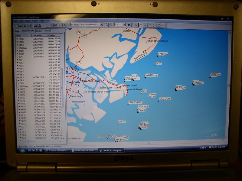
In the links section of this site you can find a link to maptech. www.maptech.com I downloaded a chart and then created a mark at all the markers and other obstructions and hazards. Then I downloaded the marks into the gps. While I don't have a map in the gps, I do have the local markers. Makes getting home at night a lot easier
Then I made this mount for my hand held gps.
The wires run through a hole under the mount that was there from a previous owner and into will go into a lighter socket that I have not yet installed behind the dash
In the links section of this site you can find a link to maptech. www.maptech.com I downloaded a chart and then created a mark at all the markers and other obstructions and hazards. Then I downloaded the marks into the gps. While I don't have a map in the gps, I do have the local markers. Makes getting home at night a lot easier
Last edited: